
Thank you for supporting this site ❤️
Make a donation
Make a donation
Botoku topographic map
Click on the map to display elevation.
Thank you for supporting this site ❤️
Make a donation
Make a donation
About this map
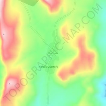
Name: Botoku topographic map, elevation, terrain.
Location: Botoku, North Dayi District, Volta Region, Ghana (6.74514 0.24883 6.78514 0.28883)
Average elevation: 219 m
Minimum elevation: 72 m
Maximum elevation: 390 m
Thank you for supporting this site ❤️
Make a donation
Make a donation