
Thank you for supporting this site ❤️
Make a donation
Make a donation
San Rafael topographic map
Click on the map to display elevation.
Thank you for supporting this site ❤️
Make a donation
Make a donation
About this map
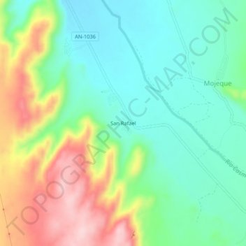
Name: San Rafael topographic map, elevation, terrain.
Location: San Rafael, Casma, Áncash, Perú (-9.55674 -78.25684 -9.51674 -78.21684)
Average elevation: 173 m
Minimum elevation: 95 m
Maximum elevation: 316 m
Thank you for supporting this site ❤️
Make a donation
Make a donation
Other topographic maps
Click on a map to view its topography, its elevation and its terrain.