
Thank you for supporting this site ❤️
Make a donation
Make a donation
Cage topographic map
Click on the map to display elevation.
Thank you for supporting this site ❤️
Make a donation
Make a donation
About this map
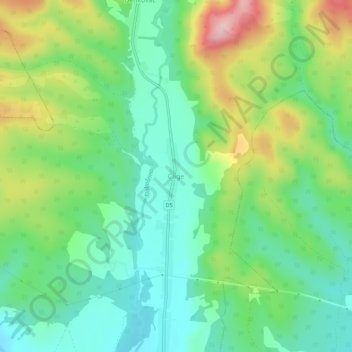
Name: Cage topographic map, elevation, terrain.
Location: Cage, Općina Okućani, Brod-Posavina County, 35430, Croatia (45.26772 17.18848 45.30772 17.22848)
Average elevation: 193 m
Minimum elevation: 112 m
Maximum elevation: 354 m
Thank you for supporting this site ❤️
Make a donation
Make a donation
Other topographic maps
Click on a map to view its topography, its elevation and its terrain.