
Thank you for supporting this site ❤️
Make a donation
Make a donation
Goldthwaite topographic map
Click on the map to display elevation.
Thank you for supporting this site ❤️
Make a donation
Make a donation
About this map
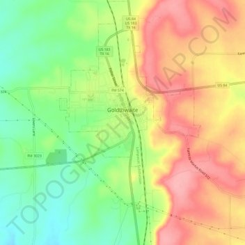
Name: Goldthwaite topographic map, elevation, terrain.
Location: Goldthwaite, Mills County, Texas, 76844, United States (31.42343 -98.60983 31.47296 -98.55133)
Average elevation: 485 m
Minimum elevation: 428 m
Maximum elevation: 539 m
Thank you for supporting this site ❤️
Make a donation
Make a donation