
Distrito San Carlos topographic map
Interactive map
Click on the map to display elevation.
About this map
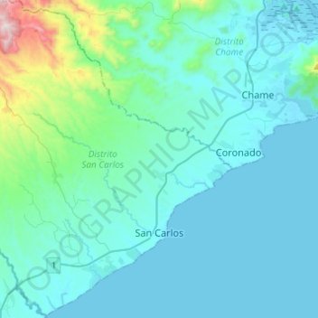
Name: Distrito San Carlos topographic map, elevation, terrain.
Location: Distrito San Carlos, Panamá Oeste, Panama (8.40791 -80.12103 8.64917 -79.90048)
Average elevation: 127 m
Minimum elevation: 0 m
Maximum elevation: 1,159 m
Other topographic maps
Click on a map to view its topography, its elevation and its terrain.