
Thank you for supporting this site ❤️
Make a donation
Make a donation
Bokkawala topographic map
Click on the map to display elevation.
Thank you for supporting this site ❤️
Make a donation
Make a donation
About this map
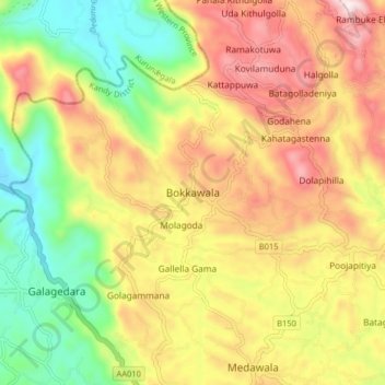
Name: Bokkawala topographic map, elevation, terrain.
Location: Bokkawala, Kandy District, Central Province, Sri Lanka (7.35340 80.51320 7.43340 80.59320)
Average elevation: 489 m
Minimum elevation: 175 m
Maximum elevation: 826 m
Thank you for supporting this site ❤️
Make a donation
Make a donation