
Thank you for supporting this site ❤️
Make a donation
Make a donation
Artic topographic map
Click on the map to display elevation.
Thank you for supporting this site ❤️
Make a donation
Make a donation
About this map
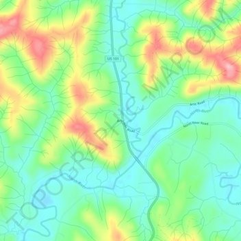
Name: Artic topographic map, elevation, terrain.
Location: Artic, Grays Harbor County, Washington, United States (46.87032 -123.73528 46.91032 -123.69528)
Average elevation: 75 m
Minimum elevation: 22 m
Maximum elevation: 175 m
Thank you for supporting this site ❤️
Make a donation
Make a donation