
Thank you for supporting this site ❤️
Make a donation
Make a donation
Randen topographic map
Click on the map to display elevation.
Thank you for supporting this site ❤️
Make a donation
Make a donation
About this map
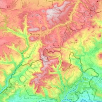
Name: Randen topographic map, elevation, terrain.
Location: Randen, Bezirk Oberklettgau, Schaffhouse, Suisse (47.69047 8.51561 47.91496 8.68967)
Average elevation: 650 m
Minimum elevation: 386 m
Maximum elevation: 934 m
Thank you for supporting this site ❤️
Make a donation
Make a donation