
Thank you for supporting this site ❤️
Make a donation
Make a donation
Kingston topographic map
Click on the map to display elevation.
Thank you for supporting this site ❤️
Make a donation
Make a donation
About this map
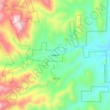
Name: Kingston topographic map, elevation, terrain.
Location: Kingston, Sierra County, New Mexico, United States (32.89702 -107.72614 32.93702 -107.68614)
Average elevation: 2,000 m
Minimum elevation: 1,821 m
Maximum elevation: 2,267 m
Thank you for supporting this site ❤️
Make a donation
Make a donation
Other topographic maps
Click on a map to view its topography, its elevation and its terrain.