
Thank you for supporting this site ❤️
Make a donation
Make a donation
Saint-Nicolas topographic map
Click on the map to display elevation.
Thank you for supporting this site ❤️
Make a donation
Make a donation
About this map
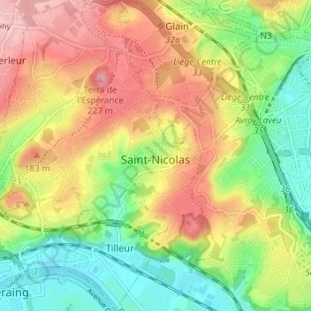
Name: Saint-Nicolas topographic map, elevation, terrain.
Location: Saint-Nicolas, Lieja, Valonia, 4420, Bélgica (50.61292 5.50661 50.65136 5.54926)
Average elevation: 124 m
Minimum elevation: 57 m
Maximum elevation: 197 m
Thank you for supporting this site ❤️
Make a donation
Make a donation
Other topographic maps
Click on a map to view its topography, its elevation and its terrain.