
Thank you for supporting this site ❤️
Make a donation
Make a donation
Troy topographic map
Click on the map to display elevation.
Thank you for supporting this site ❤️
Make a donation
Make a donation
About this map
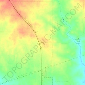
Name: Troy topographic map, elevation, terrain.
Location: Troy, Johnston County, Oklahoma, United States (34.30732 -96.80167 34.34732 -96.76167)
Average elevation: 279 m
Minimum elevation: 251 m
Maximum elevation: 301 m
Thank you for supporting this site ❤️
Make a donation
Make a donation
Other topographic maps
Click on a map to view its topography, its elevation and its terrain.