
Thank you for supporting this site ❤️
Make a donation
Make a donation
Fentonbury topographic map
Click on the map to display elevation.
Thank you for supporting this site ❤️
Make a donation
Make a donation
About this map
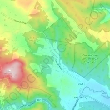
Name: Fentonbury topographic map, elevation, terrain.
Location: Fentonbury, Central Highlands, Tasmania, 7140, Australia (-42.67520 146.72850 -42.63047 146.80905)
Average elevation: 258 m
Minimum elevation: 83 m
Maximum elevation: 605 m
Thank you for supporting this site ❤️
Make a donation
Make a donation