
Thank you for supporting this site ❤️
Make a donation
Make a donation
Dryfork topographic map
Click on the map to display elevation.
Thank you for supporting this site ❤️
Make a donation
Make a donation
About this map
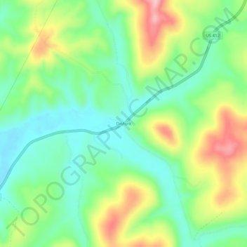
Name: Dryfork topographic map, elevation, terrain.
Location: Dryfork, Carroll County, Arkansas, United States (36.13341 -93.50908 36.17341 -93.46908)
Average elevation: 478 m
Minimum elevation: 414 m
Maximum elevation: 586 m
Thank you for supporting this site ❤️
Make a donation
Make a donation
Other topographic maps
Click on a map to view its topography, its elevation and its terrain.