
Thank you for supporting this site ❤️
Make a donation
Make a donation
Hyman topographic map
Click on the map to display elevation.
Thank you for supporting this site ❤️
Make a donation
Make a donation
About this map
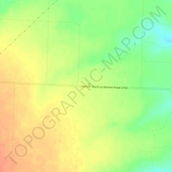
Name: Hyman topographic map, elevation, terrain.
Location: Hyman, Mitchell County, Texas, United States (32.11818 -101.15512 32.15818 -101.11512)
Average elevation: 712 m
Minimum elevation: 687 m
Maximum elevation: 729 m
Thank you for supporting this site ❤️
Make a donation
Make a donation
Other topographic maps
Click on a map to view its topography, its elevation and its terrain.