
Thank you for supporting this site ❤️
Make a donation
Make a donation
Fleisbach topographic map
Click on the map to display elevation.
Thank you for supporting this site ❤️
Make a donation
Make a donation
About this map
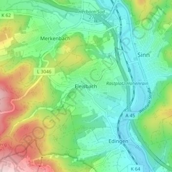
Name: Fleisbach topographic map, elevation, terrain.
Location: Fleisbach, Sinn, Lahn-Dill-Kreis, Hessen, 35764, Deutschland (50.62573 8.28924 50.66573 8.32924)
Average elevation: 270 m
Minimum elevation: 183 m
Maximum elevation: 461 m
Thank you for supporting this site ❤️
Make a donation
Make a donation
Other topographic maps
Click on a map to view its topography, its elevation and its terrain.