
Thank you for supporting this site ❤️
Make a donation
Make a donation
Tonjong topographic map
Click on the map to display elevation.
Thank you for supporting this site ❤️
Make a donation
Make a donation
About this map
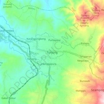
Name: Tonjong topographic map, elevation, terrain.
Location: Tonjong, Brebes, Central Java, Java, 52271, Indonesia (-7.21525 108.98649 -7.13525 109.06649)
Average elevation: 260 m
Minimum elevation: 59 m
Maximum elevation: 709 m
Thank you for supporting this site ❤️
Make a donation
Make a donation
Other topographic maps
Click on a map to view its topography, its elevation and its terrain.