
Doues topographic map
Interactive map
Click on the map to display elevation.
About this map
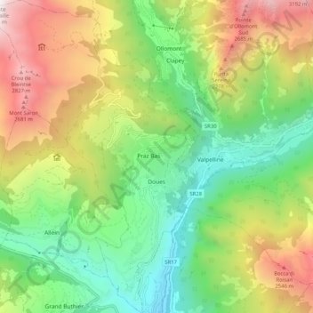
Name: Doues topographic map, elevation, terrain.
Location: Doues, Aosta Valley, Italy (45.78958 7.25439 45.86060 7.31988)
Average elevation: 1,661 m
Minimum elevation: 757 m
Maximum elevation: 3,073 m
Other topographic maps
Click on a map to view its topography, its elevation and its terrain.