
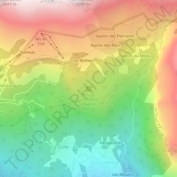
Refuge Le Châtelet d'Ayères topographic map
Interactive map
Click on the map to display elevation.
About this map
Name: Refuge Le Châtelet d'Ayères topographic map, elevation, terrain.
Average elevation: 1,408 m
Minimum elevation: 880 m
Maximum elevation: 2,022 m
Other topographic maps
Click on a map to view its topography, its elevation and its terrain.
École d'escalade de Plaine Joux
France > Auvergne-Rhône-Alpes > Haute-Savoie > Passy > Plaine Joux
École d'escalade de Plaine Joux, Route du Chatelet, Plaine Joux, Passy, Bonneville, Haute-Savoie, Auvergne-Rhône-Alpes, France métropolitaine, 74480, France
Average elevation: 1,433 m