
Thank you for supporting this site ❤️
Make a donation
Make a donation
Nedstrand topographic map
Click on the map to display elevation.
Thank you for supporting this site ❤️
Make a donation
Make a donation
About this map
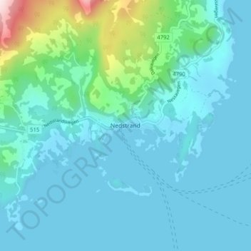
Name: Nedstrand topographic map, elevation, terrain.
Location: Nedstrand, Tysvær, Rogaland, Norvège (59.32591 5.83908 59.36591 5.87908)
Average elevation: 64 m
Minimum elevation: 0 m
Maximum elevation: 462 m
Thank you for supporting this site ❤️
Make a donation
Make a donation
Other topographic maps
Click on a map to view its topography, its elevation and its terrain.