
Thank you for supporting this site ❤️
Make a donation
Make a donation
Cipageran topographic map
Click on the map to display elevation.
Thank you for supporting this site ❤️
Make a donation
Make a donation
About this map
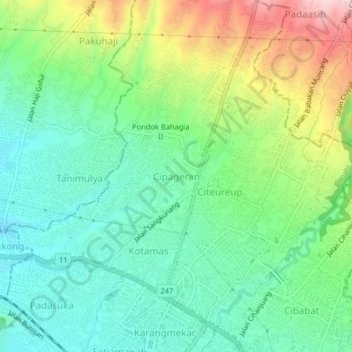
Name: Cipageran topographic map, elevation, terrain.
Location: Cipageran, Cimahi, West Java, Java, 40511, Indonesia (-6.87932 107.52255 -6.83932 107.56255)
Average elevation: 809 m
Minimum elevation: 717 m
Maximum elevation: 1,000 m
Thank you for supporting this site ❤️
Make a donation
Make a donation
Other topographic maps
Click on a map to view its topography, its elevation and its terrain.