
Thank you for supporting this site ❤️
Make a donation
Make a donation
Chiang Dao topographic map
Click on the map to display elevation.
Thank you for supporting this site ❤️
Make a donation
Make a donation
About this map
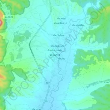
Name: Chiang Dao topographic map, elevation, terrain.
Location: Chiang Dao, Mae Na, Chiang Dao, Chiang Mai Province, Thailand (19.32957 98.92571 19.40957 99.00571)
Average elevation: 433 m
Minimum elevation: 375 m
Maximum elevation: 798 m
Thank you for supporting this site ❤️
Make a donation
Make a donation