
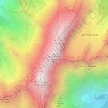
Watzmann-Mittelspitze topographic map
Interactive map
Click on the map to display elevation.
About this map
Name: Watzmann-Mittelspitze topographic map, elevation, terrain.
Average elevation: 1,895 m
Minimum elevation: 814 m
Maximum elevation: 2,683 m
Le chaînon du Watzmann culmine au Watzmann central (Watzmann-Mittelspitze), qui avec 2 713 m d'altitude est le plus haut point de la région de Berchtesgaden en Bavière.