
Reigate topographic map
Click on the map to display elevation.
Reigate
Reigate is in central Surrey, around 19 mi (30 km) south of central London and 9 mi (14 km) north of Gatwick Airport. The town is in the Vale of Holmesdale, below the North Downs escarpment. The average elevation in the centre is 80 m (260 ft) above ordnance datum (OD) and the area is drained by the Wallace Brook and its tributaries, which feed the River Mole.
About this map
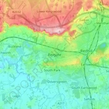
Name: Reigate topographic map, elevation, terrain.
Average elevation: 100 m
Minimum elevation: 43 m
Maximum elevation: 236 m