
Thank you for supporting this site ❤️
Make a donation
Make a donation
Franklin County topographic map
Click on the map to display elevation.
Thank you for supporting this site ❤️
Make a donation
Make a donation
About this map
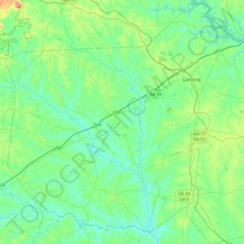
Name: Franklin County topographic map, elevation, terrain.
Location: Franklin County, Georgia, United States (34.22373 -83.39835 34.53669 -83.05190)
Average elevation: 237 m
Minimum elevation: 169 m
Maximum elevation: 515 m
Thank you for supporting this site ❤️
Make a donation
Make a donation
Other topographic maps
Click on a map to view its topography, its elevation and its terrain.