
Fröbershammer topographic map
Interactive map
Click on the map to display elevation.
About this map
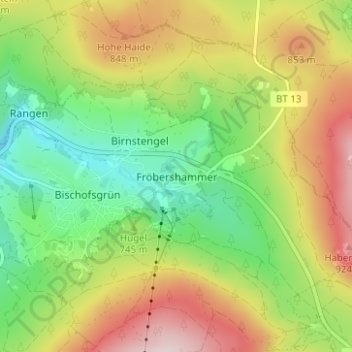
Name: Fröbershammer topographic map, elevation, terrain.
Average elevation: 757 m
Minimum elevation: 607 m
Maximum elevation: 954 m
Other topographic maps
Click on a map to view its topography, its elevation and its terrain.
Sattelbogen
Duitsland > Beieren > Landkreis Bayreuth > Betzenstein
Sattelbogen, Betzenstein, Betzenstein (VGem), Landkreis Bayreuth, Beieren, 91282, Duitsland
Average elevation: 542 m