
Thank you for supporting this site ❤️
Make a donation
Make a donation
East Ellijay topographic map
Click on the map to display elevation.
Thank you for supporting this site ❤️
Make a donation
Make a donation
About this map
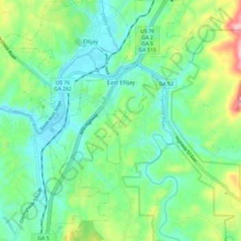
Name: East Ellijay topographic map, elevation, terrain.
Location: East Ellijay, Gilmer County, Georgia, 30539, United States (34.64078 -84.49628 34.70600 -84.44882)
Average elevation: 440 m
Minimum elevation: 373 m
Maximum elevation: 617 m
Thank you for supporting this site ❤️
Make a donation
Make a donation
Other topographic maps
Click on a map to view its topography, its elevation and its terrain.