
Thank you for supporting this site ❤️
Make a donation
Make a donation
Neukirchen topographic map
Click on the map to display elevation.
Thank you for supporting this site ❤️
Make a donation
Make a donation
About this map
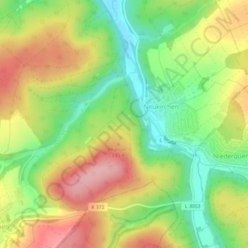
Name: Neukirchen topographic map, elevation, terrain.
Location: Neukirchen, Braunfels, Lahn-Dill-Kreis, Hessen, Deutschland (50.46646 8.41175 50.49330 8.45394)
Average elevation: 242 m
Minimum elevation: 171 m
Maximum elevation: 320 m
Thank you for supporting this site ❤️
Make a donation
Make a donation