
Thank you for supporting this site ❤️
Make a donation
Make a donation
Tczew topographic map
Click on the map to display elevation.
Thank you for supporting this site ❤️
Make a donation
Make a donation
About this map
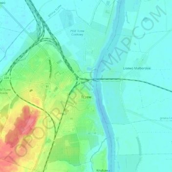
Name: Tczew topographic map, elevation, terrain.
Location: Tczew, Tczew County, Pomeranian Voivodeship, 83-110, Poland (54.06077 18.74264 54.12066 18.82058)
Average elevation: 16 m
Minimum elevation: -2 m
Maximum elevation: 72 m
Thank you for supporting this site ❤️
Make a donation
Make a donation
Other topographic maps
Click on a map to view its topography, its elevation and its terrain.