
Thank you for supporting this site ❤️
Make a donation
Make a donation
White Cloud topographic map
Click on the map to display elevation.
Thank you for supporting this site ❤️
Make a donation
Make a donation
About this map
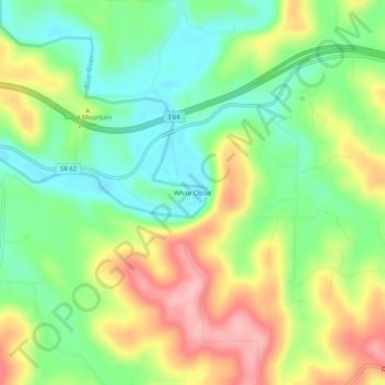
Name: White Cloud topographic map, elevation, terrain.
Location: White Cloud, Harrison County, Indiana, United States (38.20812 -86.24442 38.24812 -86.20442)
Average elevation: 188 m
Minimum elevation: 129 m
Maximum elevation: 269 m
Thank you for supporting this site ❤️
Make a donation
Make a donation
Other topographic maps
Click on a map to view its topography, its elevation and its terrain.