
Krasnoyarsk Krai topographic map
Interactive map
Click on the map to display elevation.
Krasnoyarsk Krai
There are also a large number of islands off the krai's coast, the most prominent of which are (from west to east) Sibiryakov Island, Nosok Island, Dikson Island, Vern Island, Brekhovskiye Island (in the Yenisei Gulf), Krestovskiy Island, the Kamennye Islands, the Zveroboy Islands, the Labyrintovye Islands, the Plavnikovye Islands, Kolosovykh Island, the Mona Islands, Rykacheva Island, Gavrilova Island, Belukha and Prodolgovatyy Islands, the Nordenskiöld Archipelago, the Firnley Islands, the Heiberg Islands, Starokadomsky Island, Maly Taymyr Island, the Komsomolskaya Pravda Islands, the Faddey Islands, and the Saint Peter Islands. There are also a number of islands further out that fall under the administration of Krasnoyarsk Krai - the most prominent being Bolshoy Island, Sverdrup Island, the Izvestiy TSIK Islands, the Arkticheskiy Institut Islands, the Kirov Islands, Uyedineniya Island, Voronina Island, Severnaya Zemlya (the largest group), and Ushakov Island. The highest point of the krai is Grandiozny Peak in the East Sayan Mountains at an elevation of 2,922 meters (9,587 ft).
About this map
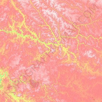
Name: Krasnoyarsk Krai topographic map, elevation, terrain.
Location: Krasnoyarsk Krai, Siberian Federal District, Russia (60.76338 94.53800 65.88338 99.65800)
Average elevation: 429 m
Minimum elevation: 38 m
Maximum elevation: 972 m
Other topographic maps
Click on a map to view its topography, its elevation and its terrain.
Khatanga
Russia > Krasnoyarsk Krai > Taymyrsky Dolgano-Nenetsky District
Khatanga (Russian: Ха́танга) is a rural locality (a selo) in Taymyrsky Dolgano-Nenetsky District of Krasnoyarsk Krai, Russia, located on the Khatanga River on the Taymyr Peninsula. It is one of the northernmost inhabited localities in Russia. Its elevation is 30 metres (98 ft) above sea level. As of…
Average elevation: 11 m
October Revolution Island
Russia > Krasnoyarsk Krai > городское поселение Диксон
Average elevation: 171 m