
Thank you for supporting this site ❤️
Make a donation
Make a donation
Petit Sart topographic map
Click on the map to display elevation.
Thank you for supporting this site ❤️
Make a donation
Make a donation
About this map
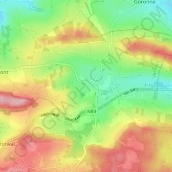
Name: Petit Sart topographic map, elevation, terrain.
Location: Petit Sart, Lierneux, Verviers, Liège, Wallonie, 4990, Belgique (50.24921 5.82460 50.28921 5.86460)
Average elevation: 477 m
Minimum elevation: 403 m
Maximum elevation: 563 m
Thank you for supporting this site ❤️
Make a donation
Make a donation