
Thank you for supporting this site ❤️
Make a donation
Make a donation
Tahult topographic map
Click on the map to display elevation.
Thank you for supporting this site ❤️
Make a donation
Make a donation
About this map
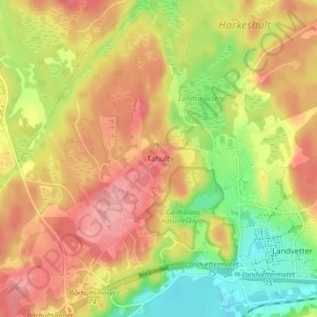
Name: Tahult topographic map, elevation, terrain.
Location: Tahult, Härryda kommun, Västra Götaland County, 438 35, Sweden (57.68033 12.16731 57.72033 12.20731)
Average elevation: 111 m
Minimum elevation: 52 m
Maximum elevation: 160 m
Thank you for supporting this site ❤️
Make a donation
Make a donation
Other topographic maps
Click on a map to view its topography, its elevation and its terrain.