
Thank you for supporting this site ❤️
Make a donation
Make a donation
Wadi Rum desert topographic map
Click on the map to display elevation.
Thank you for supporting this site ❤️
Make a donation
Make a donation
Wadi Rum desert
The area is centered on the main valley of Wadi Rum. The highest elevation in Jordan is Jabal Umm ad Dami at 1,840 m (6,040 ft) high (SRTM data states 1854 m), located 30 kilometres south of Wadi Rum village. It was first located by Difallah Ateeg, a Zalabia Bedouin from Rum. On a clear day, it is possible to see the Red Sea and the Saudi border from the top.
Thank you for supporting this site ❤️
Make a donation
Make a donation
About this map
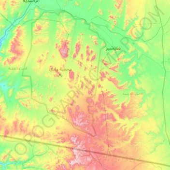
Name: Wadi Rum desert topographic map, elevation, terrain.
Average elevation: 1,041 m
Minimum elevation: 637 m
Maximum elevation: 1,831 m
Thank you for supporting this site ❤️
Make a donation
Make a donation