
Thank you for supporting this site ❤️
Make a donation
Make a donation
Monthey topographic map
Click on the map to display elevation.
Thank you for supporting this site ❤️
Make a donation
Make a donation
About this map
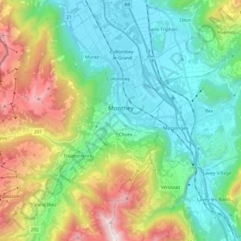
Name: Monthey topographic map, elevation, terrain.
Location: Monthey, Wallis, Switzerland (46.19285 6.80332 46.30000 6.97922)
Average elevation: 933 m
Minimum elevation: 374 m
Maximum elevation: 2,271 m
Thank you for supporting this site ❤️
Make a donation
Make a donation