
Thank you for supporting this site ❤️
Make a donation
Make a donation
Bad Endorf topographic map
Click on the map to display elevation.
Thank you for supporting this site ❤️
Make a donation
Make a donation
About this map
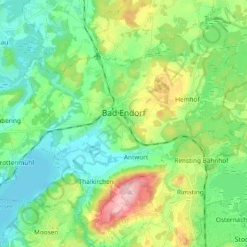
Name: Bad Endorf topographic map, elevation, terrain.
Location: Bad Endorf, Landkreis Rosenheim, Bayern, 83093, Deutschland (47.86594 12.23306 47.93897 12.36467)
Average elevation: 534 m
Minimum elevation: 468 m
Maximum elevation: 696 m
Thank you for supporting this site ❤️
Make a donation
Make a donation
Other topographic maps
Click on a map to view its topography, its elevation and its terrain.