
Tangala topographic map
Interactive map
Click on the map to display elevation.
About this map
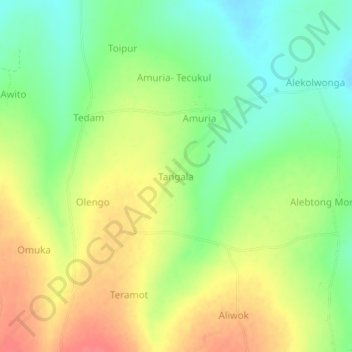
Name: Tangala topographic map, elevation, terrain.
Location: Tangala, Alebtong, Northern Region, Ouganda (2.28908 33.20929 2.32908 33.24929)
Average elevation: 1,066 m
Minimum elevation: 1,038 m
Maximum elevation: 1,097 m