
Thank you for supporting this site ❤️
Make a donation
Make a donation
Kvilldal topographic map
Click on the map to display elevation.
Thank you for supporting this site ❤️
Make a donation
Make a donation
About this map
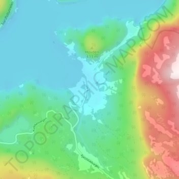
Name: Kvilldal topographic map, elevation, terrain.
Location: Kvilldal, Suldal, Rogaland, Norvège (59.49647 6.61637 59.53647 6.65637)
Average elevation: 278 m
Minimum elevation: 58 m
Maximum elevation: 879 m
Thank you for supporting this site ❤️
Make a donation
Make a donation
Other topographic maps
Click on a map to view its topography, its elevation and its terrain.