
Villanova topographic map
Interactive map
Click on the map to display elevation.
About this map
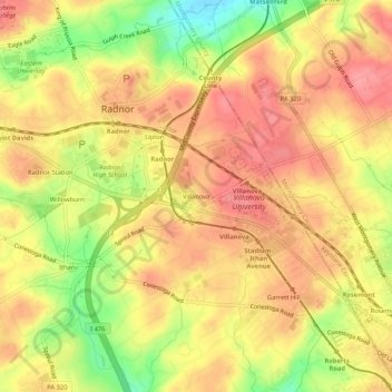
Name: Villanova topographic map, elevation, terrain.
Average elevation: 119 m
Minimum elevation: 65 m
Maximum elevation: 149 m
Other topographic maps
Click on a map to view its topography, its elevation and its terrain.
Garrett Hill
United States > Pennsylvania > Delaware County > Radnor Township > Radnor
Garrett Hill, Radnor, Radnor Township, Delaware County, Pennsylvania, 19010, United States
Average elevation: 117 m