
Thank you for supporting this site ❤️
Make a donation
Make a donation
Sustenhorn topographic map
Click on the map to display elevation.
Thank you for supporting this site ❤️
Make a donation
Make a donation
Sustenhorn
Le Sustenhorn est un sommet des Alpes uranaises, en Suisse. Il culmine à 3 502 m d'altitude.
Thank you for supporting this site ❤️
Make a donation
Make a donation
About this map
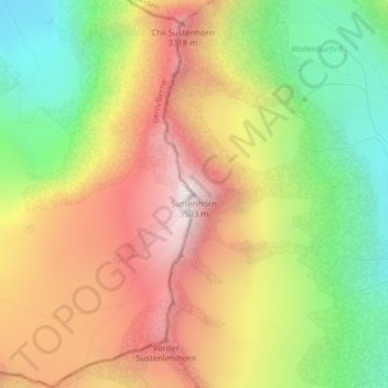
Name: Sustenhorn topographic map, elevation, terrain.
Location: Sustenhorn, Göschenen, Uri, 6487, Suisse (46.69887 8.45515 46.69897 8.45525)
Average elevation: 2,857 m
Minimum elevation: 2,242 m
Maximum elevation: 3,480 m
Thank you for supporting this site ❤️
Make a donation
Make a donation
Other topographic maps
Click on a map to view its topography, its elevation and its terrain.