
Thank you for supporting this site ❤️
Make a donation
Make a donation
Botyre (Ayent) topographic map
Click on the map to display elevation.
Thank you for supporting this site ❤️
Make a donation
Make a donation
About this map
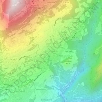
Name: Botyre (Ayent) topographic map, elevation, terrain.
Location: Botyre (Ayent), Ayent, Hérens, Valais, 1966, Suisse (46.25659 7.38498 46.29659 7.42498)
Average elevation: 1,020 m
Minimum elevation: 506 m
Maximum elevation: 1,854 m
Thank you for supporting this site ❤️
Make a donation
Make a donation