
Thank you for supporting this site ❤️
Make a donation
Make a donation
Hanover topographic map
Click on the map to display elevation.
Thank you for supporting this site ❤️
Make a donation
Make a donation
About this map
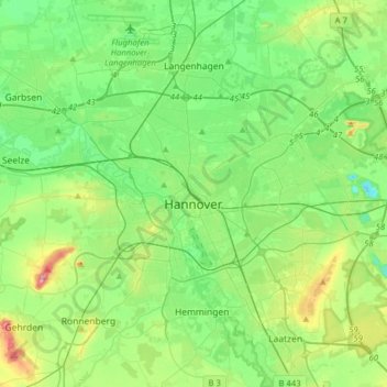
Name: Hanover topographic map, elevation, terrain.
Location: Hanover, Region Hannover, Lower Saxony, Germany (52.30514 9.60443 52.45433 9.91843)
Average elevation: 61 m
Minimum elevation: 21 m
Maximum elevation: 168 m
Thank you for supporting this site ❤️
Make a donation
Make a donation