
Thank you for supporting this site ❤️
Make a donation
Make a donation
Temple topographic map
Click on the map to display elevation.
Thank you for supporting this site ❤️
Make a donation
Make a donation
Temple
Temple is a census-designated place in Muhlenberg Township, Berks County, Pennsylvania, United States at an elevation of 361 feet (110 m). The community was named for a local inn called Solomon's Temple. Temple was an independent borough until it was disincorporated on January 1, 1999. The ZIP code is 19560. As of the 2020 census the population was 2,073 residents.
Thank you for supporting this site ❤️
Make a donation
Make a donation
About this map
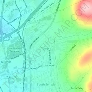
Name: Temple topographic map, elevation, terrain.
Average elevation: 126 m
Minimum elevation: 76 m
Maximum elevation: 274 m
Thank you for supporting this site ❤️
Make a donation
Make a donation