
Thank you for supporting this site ❤️
Make a donation
Make a donation
Rock Springs topographic map
Click on the map to display elevation.
Thank you for supporting this site ❤️
Make a donation
Make a donation
About this map
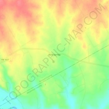
Name: Rock Springs topographic map, elevation, terrain.
Location: Rock Springs, Bosque County, Texas, 76688, United States (31.66599 -97.43668 31.70599 -97.39668)
Average elevation: 198 m
Minimum elevation: 160 m
Maximum elevation: 229 m
Thank you for supporting this site ❤️
Make a donation
Make a donation
Other topographic maps
Click on a map to view its topography, its elevation and its terrain.