
Grote Markt topographic map
Interactive map
Click on the map to display elevation.
About this map
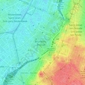
Name: Grote Markt topographic map, elevation, terrain.
Average elevation: 42 m
Minimum elevation: 16 m
Maximum elevation: 88 m
Other topographic maps
Click on a map to view its topography, its elevation and its terrain.
Brussel
België > Brussel-Hoofdstad > Brussel
Brussel, Brussel-Hoofdstad, Brussel Hoofdstad, België
Average elevation: 56 m
Warandepark
België > Brussel-Hoofdstad > Brussel
Warandepark, Vijfhoek, Brussel, Brussel-Hoofdstad, Brussel Hoofdstad, 1000, België
Average elevation: 53 m
Zavel
België > Brussel-Hoofdstad > Brussel
Zavel, Vijfhoek, Brussel, Brussel-Hoofdstad, Brussel Hoofdstad, 1000, België
Average elevation: 53 m