
Thank you for supporting this site ❤️
Make a donation
Make a donation
Wangqing topographic map
Click on the map to display elevation.
Thank you for supporting this site ❤️
Make a donation
Make a donation
About this map
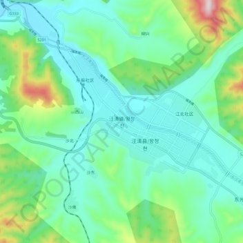
Name: Wangqing topographic map, elevation, terrain.
Location: Wangqing, Wangqing County, Yanbian, Jilin, China (43.27781 129.71063 43.35781 129.79063)
Average elevation: 314 m
Minimum elevation: 207 m
Maximum elevation: 677 m
Thank you for supporting this site ❤️
Make a donation
Make a donation