
Gałki topographic map
Interactive map
Click on the map to display elevation.
About this map
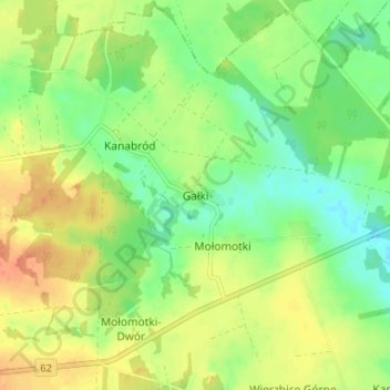
Name: Gałki topographic map, elevation, terrain.
Average elevation: 145 m
Minimum elevation: 126 m
Maximum elevation: 166 m
Other topographic maps
Click on a map to view its topography, its elevation and its terrain.
Rudniki
Poland > Masovian Voivodeship > Sokołów County
Rudniki, gmina Repki, Sokołów County, Masovian Voivodeship, 08-307, Poland
Average elevation: 126 m