
Thank you for supporting this site ❤️
Make a donation
Make a donation
La Mitisús topographic map
Click on the map to display elevation.
Thank you for supporting this site ❤️
Make a donation
Make a donation
About this map
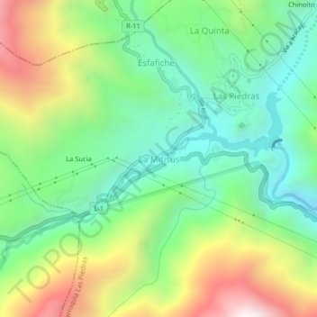
Name: La Mitisús topographic map, elevation, terrain.
Average elevation: 1,946 m
Minimum elevation: 1,504 m
Maximum elevation: 2,727 m
Thank you for supporting this site ❤️
Make a donation
Make a donation
Other topographic maps
Click on a map to view its topography, its elevation and its terrain.
Páramo de Santo Domingo
Venezuela > Merida State > Municipio Cardenal Quintero
Average elevation: 3,739 m