
Winzerhausen topographic map
Interactive map
Click on the map to display elevation.
About this map
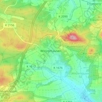
Name: Winzerhausen topographic map, elevation, terrain.
Average elevation: 273 m
Minimum elevation: 218 m
Maximum elevation: 377 m
Other topographic maps
Click on a map to view its topography, its elevation and its terrain.
Winzerhausen
Deutschland > Baden-Württemberg > Landkreis Ludwigsburg > Großbottwar
Winzerhausen, Großbottwar, Landkreis Ludwigsburg, Baden-Württemberg, Deutschland
Average elevation: 274 m