
Ifigha topographic map
Interactive map
Click on the map to display elevation.
About this map
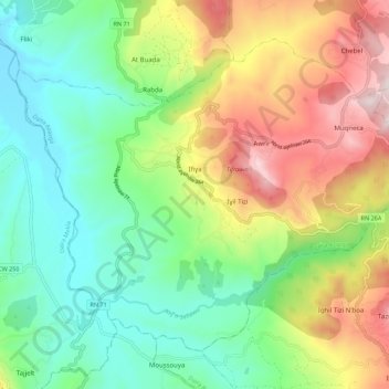
Name: Ifigha topographic map, elevation, terrain.
Location: Ifigha, Daïra Azazga, Tizi Ouzou, Algérie (36.62986 4.36283 36.70117 4.47355)
Average elevation: 466 m
Minimum elevation: 152 m
Maximum elevation: 1,011 m
Other topographic maps
Click on a map to view its topography, its elevation and its terrain.
Hendou
Algérie > Tizi Ouzou > Daïra Azazga > Azazga
Hendou, Azazga, Daïra Azazga, Tizi Ouzou, 15300, Algérie
Average elevation: 421 m