
Thank you for supporting this site ❤️
Make a donation
Make a donation
Ihuari topographic map
Click on the map to display elevation.
Thank you for supporting this site ❤️
Make a donation
Make a donation
About this map
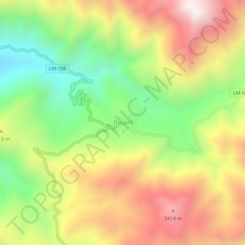
Name: Ihuari topographic map, elevation, terrain.
Location: Ihuari, Ihuarí, Huaral, Lima, Perú (-11.20890 -76.97206 -11.16890 -76.93206)
Average elevation: 2,974 m
Minimum elevation: 2,434 m
Maximum elevation: 3,553 m
Thank you for supporting this site ❤️
Make a donation
Make a donation